
Walk an East Baton Rouge Street
A sound street-by-street search begins with the place, not a guessed resident name. East Baton Rouge Parish maintains an official address-point layer, parcel geometry, tax assessments, and recorded land instruments. Those layers can show where an address sits, which assessment is linked to it, and which parties appear in a deed. None alone proves who sleeps there now. A mailing address may differ from the physical, or situs, address. A tax-roll owner may be an entity, an heir group, or someone who receives mail elsewhere.
Use this order for a repeatable East Baton Rouge Parish street directory search. Save the query date and the exact spelling at each step, since road labels and live portal screens can change.
- Normalize the street number and name with the City-Parish address point or USPS lookup. Keep directional prefixes and suffixes.
- Search SmartCAMA by physical street number and name. Record the assessment number, mapping number, legal description, and owner field.
- Open the same location in EBRGIS. Check parcel boundaries, jurisdiction, subdivision, ZIP, and nearby address points.
- Use the legal description or parcel reference in the Clerk conveyance index. Search both vendor and vendee directions to follow transfers.
- For an older household, consult dated directories and maps. Treat every directory entry as evidence for its publication year only.
The voter portal is not a reverse-address directory. Louisiana explicitly says voter and address records are not linked in that public tool. Use it only through its official name, parish, and personal verification routes.
East Baton Rouge Address Fields
The East Baton Rouge Parish SmartCAMA search accepts more than a simple address. Its separate fields help when a spelling is uncertain or when one street number covers several tax items. Search broadly first, then add a subdivision, lot, or block only when needed. Results may show both mailing and physical addresses, so label each one correctly in notes.
| Search field | Use | Key caution |
|---|---|---|
| Assessment No. | Retrieve a known assessment | Not the Clerk's recorded-document number |
| Physical Street No. | Narrow one site on a road | Units or ranges may need a broader search |
| Physical Street Name / Other | Find the standardized road label | Try variants such as Saint and St. |
| Subdivision, Lot, Block | Reconcile a parcel with a plat | Verify against the recorded legal description |
| Owner or Business | Cross-check a known tax-roll name | Does not prove present occupancy or title |
The detail tabs include Tax Items, Parcels, Legal, Ownership, Transfers, and Taxes. Ownership fractions, from and to dates, physical ZIP, and primary-owner flags can clarify a result, yet the Clerk's recorded instrument remains the source for the land transaction.
The official SmartCAMA screen shows how the search fields are split.
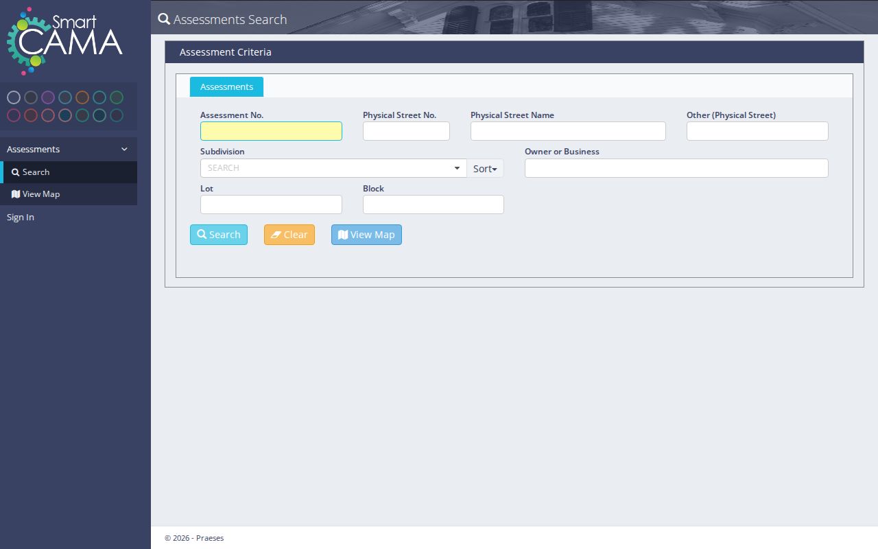
That layout makes it possible to move from a street spelling to a parcel without treating the owner box as a list of current residents.
East Baton Rouge Street Standards
Official City-Parish street-address metadata explains a local split that matters. Baker, Central, and Zachary assign their own addresses and share the data with City-Parish GIS. The common map is a good first check, but the municipality may be the right custodian when an address is new, missing, or wrong. Address points are maintained weekly, and the dataset carries no warranty.
Search spelling can change the outcome. The research notes distinguish Saint Louis from St. Louis, numbered words from digits, directional prefixes, suffixes, and apartment or unit text. Begin with the official address point, then try a normalized variant. Do not silently rewrite the source form in your notes. The parish property lookup also allows address number and street, subdivision, business name, NAICS code, and Lot Identification Number.
The official address metadata page documents the source and maintenance of those points.
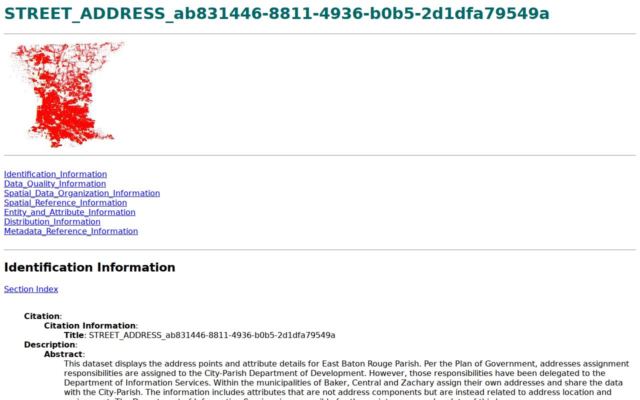
The metadata is part of the evidence: record the layer name and query date beside any address conclusion.
East Baton Rouge Street Records
An East Baton Rouge Parish street directory must keep record types separate. The address point validates location, the assessor links an assessment to a parcel, and the Clerk supplies the public recording trail. Maps add context but do not certify title. Historical tools can document past names and uses, not present residence.
| Record Set | Keeper | What It Shows | Access |
|---|---|---|---|
| Address points | City-Parish GIS and municipalities | Standard number, road name, and location | Free GIS data |
| Assessment roll | EBR Parish Assessor | Tax owner, mailing and physical address, legal fields | Free SmartCAMA search |
| Parcel and jurisdiction maps | EBRGIS | Geometry, ZIP, neighborhood, city limits, land use | Free viewers and services |
| Conveyances and mortgages | EBR Clerk of Court | Recorded parties, instrument, date, legal description | ClerkConnect subscription or in person |
| Neighborhood activity | Open Neighborhood BR | Dated permits, 311, traffic, and incident activity | Free address/date map |
| Old maps and directories | EBRPL, Clerk Archives, State Archives | Past street names, addresses, people, and institutions | Online, mail, or in person |
If an online screen fails, contact the custodian. Assessor staff can help with assessment and parcel-card access. The Clerk offers free in-person inspection during regular public hours, paid copies, ClerkConnect subscriptions, and public-record requests. Archives at 444 St. Louis Street holds older indexes, notarial bundles, and tax rolls. A narrow request should give the street, parcel or legal description, date range, and record type.
East Baton Rouge Parcel Terms
Several record words look alike but do different jobs. Define them before merging notes from the street directory, tax roll, map, and deed.
- Parcel
- A mapped unit used for assessment and land records. It is not a household.
- Situs address
- The physical location of property, which can differ from the owner's mailing address.
- Plat
- A recorded map of lots, blocks, streets, or subdivisions.
- Criss-cross directory
- A later directory section arranged by street or address instead of surname.
A legal description may cite a lot, block, subdivision, section, or earlier instrument without using the current street address. Preserve that text and reconcile it to GIS. Never replace it with a postal label.
Deeds Along East Baton Rouge Streets
The East Baton Rouge Parish Clerk Recording Department separates conveyance from mortgage indexes. Conveyances use vendor and vendee directions, while mortgage records use mortgagor and mortgagee. A deed search should capture the Original and Bundle number, recordation date and time, instrument type, parties, legal description, and any map or plan reference.
ClerkConnect provides online inquiry and images through paid passes. The published access page lists a 24-hour pass, 30-day and annual tiers, per-page printing, and a certified-document charge. In-person inspection is free, with copy charges. These are distinct outcomes: an index hit points to a record, an image shows its text, and a certified copy is the Clerk's formal copy.
The official recording page shows the local document route.

Use that office when the assessment record and the latest recorded transfer appear to disagree.
Note: A tax-roll name is a lead, while a recorded instrument is the source for a documented transfer.
Map East Baton Rouge Streets
The City-Parish property lookup covers the entire parish, including Baton Rouge, Baker, Central, Zachary, and unincorporated areas. It links ownership questions to the Assessor rather than posing as a resident list. The map can resolve a parcel, subdivision, municipality, neighborhood, and ZIP before the researcher contacts a keeper.
The official property lookup is a practical location-first screen.
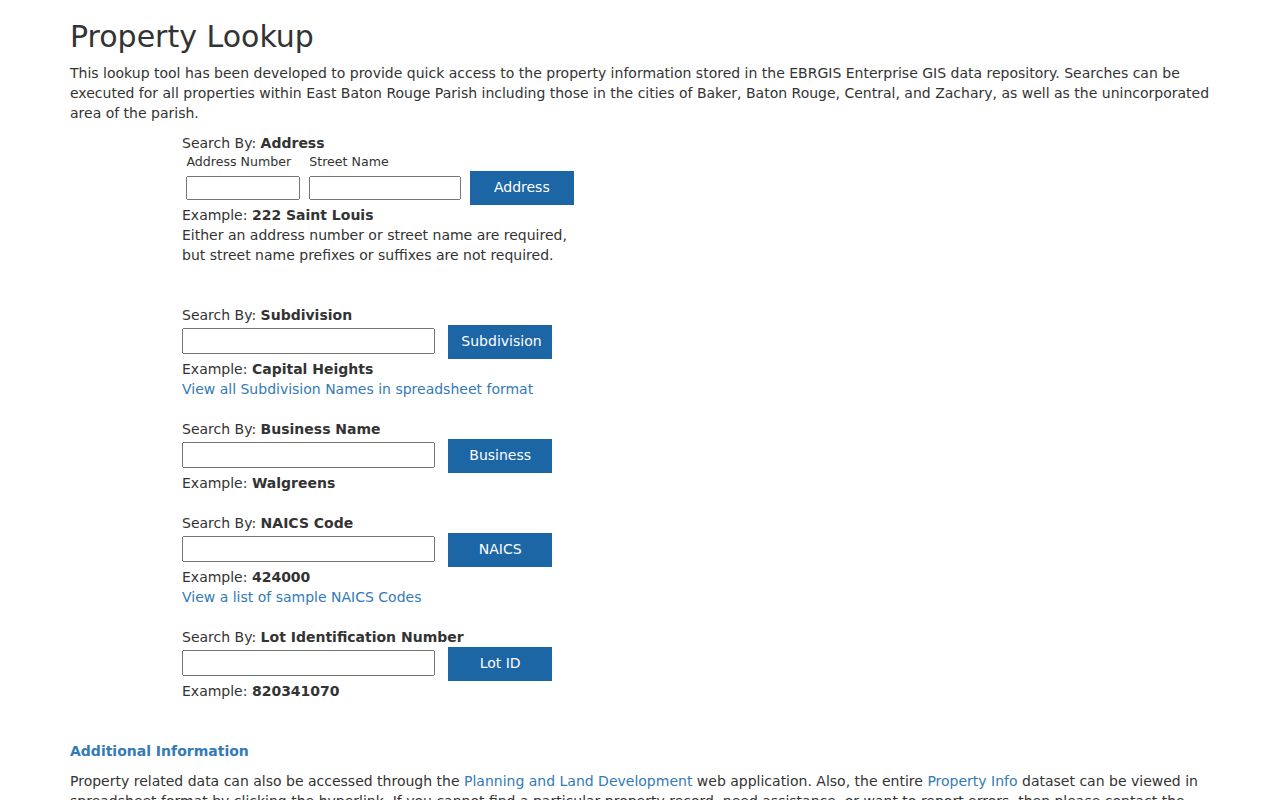
Its map result should be paired with the assessor card and deed image, not used as proof of a person's residence.
For civic context, the Neighborhood Registry maps more than 400 neighborhood-based organizations. It offers public organization contacts, not member rosters.
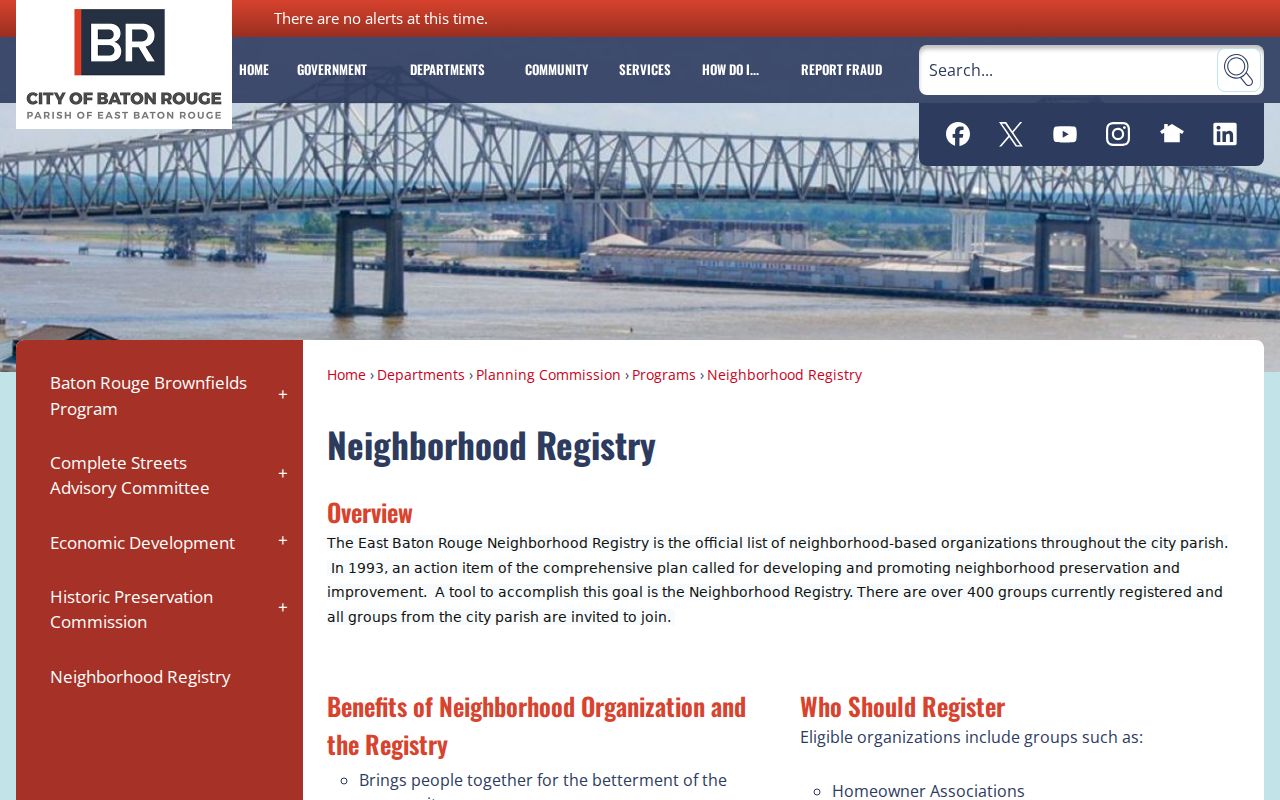
The boundary can identify the right civic group without implying that any nearby resident belongs to it.
East Baton Rouge Address Activity
Open Neighborhood BR adds a dated event layer. Users can search by address and date range, then filter crime incidents, permits, traffic incidents, and 311 activity. Neighborhood, ZIP, and Metro Council filters help frame a corridor. An event near a parcel is not evidence about its residents.
The official Open Neighborhood BR page explains this public map.
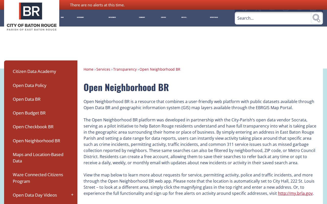
This screen is most useful after the address has been standardized and the correct local jurisdiction is known.
Old East Baton Rouge Street Clues
Historical addresses need dated maps. The Baton Rouge Digital Archive includes an 1885 official city map with streets, churches, public buildings, and subdivisions. The 1895 city directory adds names, roles, and residence lines. Later, the Clerk's 1963 to 1985 map index is divided into year ranges and alphabet bands. Those three sources can reveal a road, subdivision, or institution absent from a current search.
Consolidation also changed context. The city-parish plan took effect in 1949 after Baton Rouge had expanded beyond its older limits. Annexation layers record later changes involving Baker, Central, Zachary, and Saint George. When an old label conflicts with today's mailing city, search both, then verify the present jurisdiction in GIS. Detailed work with the historical volumes belongs in the East Baton Rouge Parish city directory collections.
Limits of East Baton Rouge Street Records
No official East Baton Rouge Parish street directory supplies a full, current household roster. The assessor records a tax relationship. A deed names parties to an instrument. GIS shows geography. Open Neighborhood BR shows dated public activity. None proves that every named person lives at the site now, and absence from a portal proves little. Renters, family members, recent moves, data lags, and restricted records all create gaps.
Louisiana's voter portal does not link its voter and address records for reverse searching. Protected voter fields remain restricted, and the Address Confidentiality Program uses a substitute address to protect a person's physical location. Never try to reverse-match such an address. Use public address records for family history, property research, consumer safety, or civic curiosity, and verify a consequential conclusion with the custodian.
Lawful use. East Baton Rouge Parish address records are for lawful personal research. Never use them to stalk, harass, intimidate, or expose a protected location.